
New street signs provide easier navigation across campus
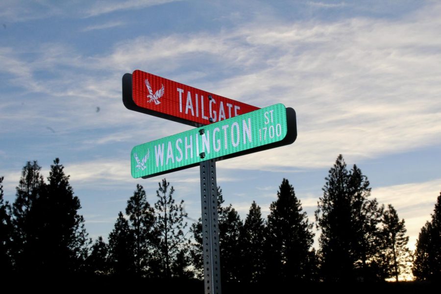
Tailgate road leads to the upper parking lot behind Roos Field. Red signs have been placed around the EWU campus to help guide new students and visitors.
January 10, 2019
EWU Construction and Planning Services is launching the Campus Fire Life Safety Signage Project to bring EWU into compliance with the IFC.
The city of Cheney informed EWU that buildings did not meet the addressing standard for the city.
“The city follows the 2015 International Fire Code, which states that buildings must have legible addresses with street-view visibility,” Shawn King, EWU’s Facilities and Planning associate vice president said.
Navigating the EWU campus can be daunting for visitors and new students trying to find where classroom buildings and departments are located.
The project will cover lane signage, update google maps and provide locations on all the campus buildings.
“All the data will be uploaded into the county system,” King said. “In the process, addresses will have GPS coordinates partly for emergency services to say we know the coordinates and we know exactly where they need to go.”
Addresses will be placed into google maps for students to look up buildings by using their mobile devices.
The additional address changes are not intended to be a detriment, but to help students, delivery services and local and outside emergency responders navigate quickly and efficiently to a specific location.
“The additional address changes does not change the mail stops for anyone on campus and the location of the department doesn’t change,” Facilities and Planning administrative assistant Jacquelyn Early said. “It’s just an additional address piece.”
Originally, the previous address format was 101 Tawanka Hall Cheney, WA 99004. Now the new address format will be changed to 501 Quad LN 101 Tawanka Commons Cheney, WA 99004.
EWU and Cheney Police contributed to the signage project.
“Cheney Police as well as us, were in collaboration with the fire department and outside emergency services to try to come up with the best solution to handle outside agencies coming in to administer in the event that students needed it,” EWU Police Deputy Chief Jewell Day said. “Out of that is born the signage project.”
There was a lot of planning that went into the signage project between the EWU Police Department and Construction and Planning Services.
“We had several meetings over several months to come up with both names as well as the best way to implement what the signage was going to look like, where we are going to place them both on the roads themselves as well as the buildings,” Day Said.
King explains that the street signs were labeled with generic names that would make them original to the campus, since some of the lanes couldn’t have the same as a city street sign or city street.
“What we tried to do when we started to do the layout of the lanes, and this was in conjunction with the city of Cheney, we said let’s have some names that are representative of the functions that will be in those areas,” King said.
For example Tailgate Lane correlates to tailgate area, and Athletics Lane would represent the athletics area near the Phase Building and Roos Field.
The distinction between the lanes and the city streets are represented in two different colored signs.
“The red street signs are the private lanes are our streets,” said Construction and Planning Services fire protection engineer Mike Lunneborg. “The green signs meet the city standard for the city street which is why you’ll see two different color signs where the new streets are.”
Anyone with any questions about the Campus Fire Life Safety Signage Project can email the Facilities and Planning department at [email protected].